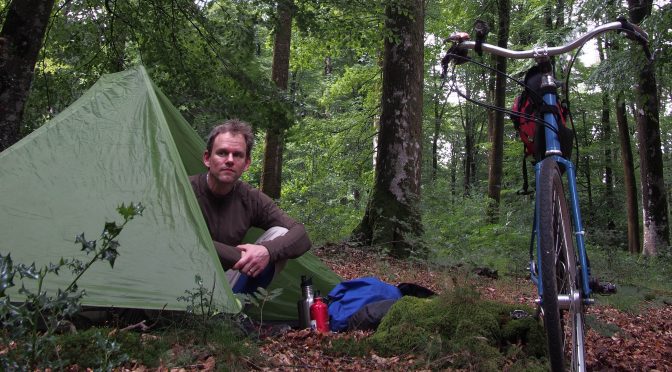
I have gone on three bike tours in Europe, mostly in France, but also in Germany, Italy, Ireland, and Switzerland. I just wanted to give a quick rundown of the ways that I have been able to find campsites, and also hopefully attract other people to this page you can tell me what to do for other countries. This is about commercial (or often municipal) campsites, not wild camping.
Wherever You Are: Try OsmAnd.
I have only done this within France, but there’s no reason that it wouldn’t work in other countries except that the data coverage might not be as good. OsmAnd is an Android and iOS application that shows OpenStreetMap data, which is sort of like the Wikipedia of cartography. It also has the best filter to show a particular feature type — like campsites — even better than the online OpenStreetMap.
Last summer I spent two weeks biking a loop in Normandy, and used this method almost every night in order to find a campsite. The main advantage of OsmAnd is that it has a lot of information, so it has both municipal and commercial campsites. The downside is that the data is not necessarily verified. One time I showed up at a campsite, and it used to be a campsite, but had become more like a trailer park. The people living there were friendly so I stayed there anyway. And the other ten times I used it I found a for-reals campsite. The idea is: there’s probably going to be a campsite where they are indicated, but is not guaranteed. I try to search all the campsites I might to go; usually I research the first weeks’s worth week before I leave, and then spend time scoping out new ones when I have downtime.
The user interface of OsmAnd is decent but complex and it took me a few tries to figure out how to display campsites on the map. Here’s a video of me showing how to find the campsites using OsmAnd:
French campsites are rated on a star system, which sometimes is included in the OSM data for the campsite if you tap on it. Fewer stars is, of course, cheaper. One or two stars is like a field with a bathroom. Three stars seems to usually have a restaurant. Four stars and above seems to mostly involve kid amenities like waterslides and bouncy houses. Anything campsite that has “municipal” in the title (i.e., run by the town) is usually going to be one star and very cheap (once I found one that was free!). Anything called an “Aire de Camping” is also usually cheap.
I’d be interested in hearing from anyone else who has used this method in other countries, and how accurate the campsite data is. Using “drinking water” as the this method is also highly reliable at finding public water spigots, often hidden in plain sight.
Overpass Turbo
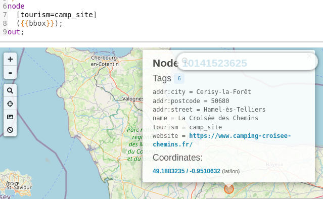 This is another OpenStreetMap tool. I’ve only used it on a desktop computer, but it gives a view on the same data. Go to https://overpass-turbo.eu/ and replace “amenity=drinking_water” with “tourism=camp_site”, and then click “Run” and it will find sites in the current viewbox. If you move the map, you have to click “Run” again.
Country-by-Country Maps.
In Germany, another good way to find campsites are ADFC biking maps. The ADFC is the national biking organization for Germany, and their maps show bike routes, bike shops, restaurants, and… campgrounds. They also exist as digital downloads, which requires some navigation of their only-in-German website.
In France, Camping Qualite is a kind of campsite industry association that has its own map. They are usually going to be more full-featured and expensive campsites (so like twenty euros a night, with a pool and a playground).
In Switzerland, the website Schweitzmobil has a configurable map that will show the Swiss national and regional bike routes, and various categories of accommodations. Probably the most useful configuration for readers of this post is showing national bike routes, camping, and farm accommodations.
What others sources for finding campsites for bike touring are there?
Leave a Reply