Category: Bicycles
-
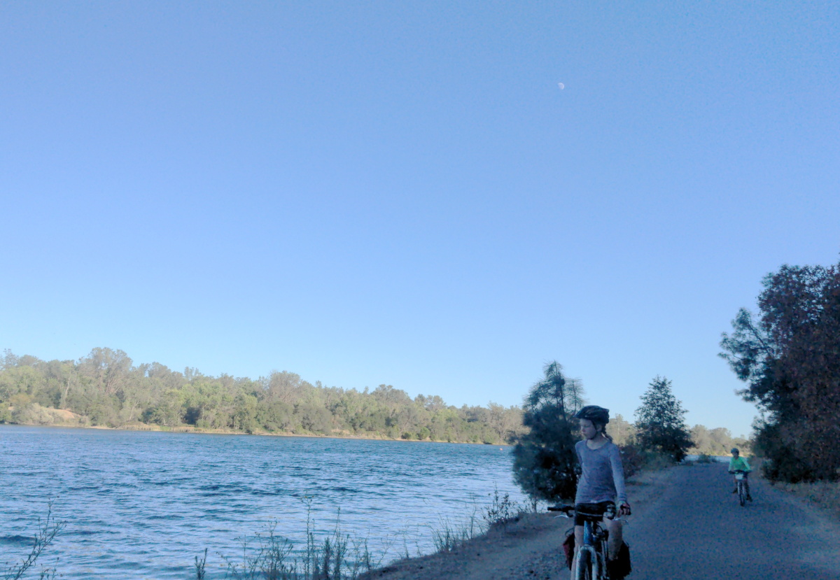
Sacramento Amtrak to Beals Point Overnight (with kids)
Introduction. This week, I was on a sort of staycation where I live in Oakland, off of work but not traveling someplace. So I decided to knock off of my to-do list something I have wanted to do for a long time: taking the train from Oakland to Sacramento to ride on the American River…
-
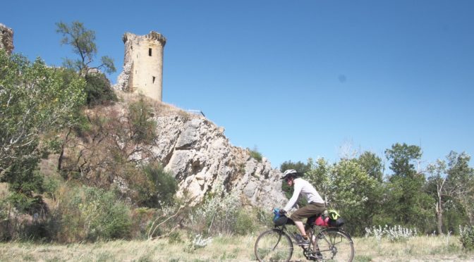
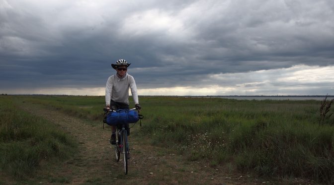
Bike Tour 2022: Rhône and Mediterranean
In July of 2022 I had the opportunity to bike tour for a couple of weeks. I bought a cheap bike in Lyon and expected to maybe reach Marseille or Montpelllier. But there were quite strong tailwinds down the Rhône and I ended up in Perpignan before I ran out of time. It was overall…
-
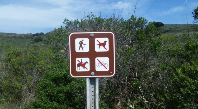
Bikes and Hiker-Only Trails
I’m mostly a cyclist. I’d always rather bike than drive, and usually rather bike than walk. But sometimes, I do go for a walk, and this weekend I went for a hike on the Pomo Canyon trail in the Sonoma Coast State park. When I got there and walked past the no-bikes, no-dogs, no-horses sign,…
-
Bike overnight: East Bay to Black Mountain Backpack Camp
Executive Summary and Recommendations This is a 24 hour overnight bike trip, starting and ending in East San Francisco Bay, to Black Mountain Backpack Camp on the peninsula. I took Capital Corridor to Santa Clara on day one (San Jose Diridon would actually be better). There’s not that many trains, so check the schedule (carefully!…
-
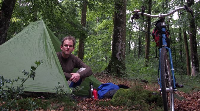
Forest, Beach, and River: A Solo Bike Tour of Normandy
[Note: this is a long (but entertaining) story. If you’re just here for the pictures, here’s the gallery , or scroll to the bottom] Preface: April 2017. This trip happened in July and August of 2017, but its story began in April. My wife and I had a one-year old, and had recently decided to have…
-
Map of Normandy Tour
This is a map of my tour that is written up in this post. It may not work with all browsers; it did not render for me on a mobile device (Chrome on Android), so if you’re not seeing anything here, maybe try a different device or browser.
-
How To Find Campsites While Bike Touring In Europe
I have gone on three bike tours in Europe, mostly in France, but also in Germany, Italy, Ireland, and Switzerland. I just wanted to give a quick rundown of the ways that I have been able to find campsites, and also hopefully attract other people to this page you can tell me what to do…
-
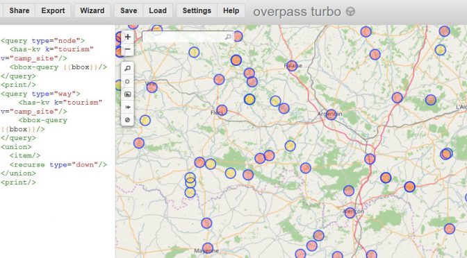
Finding campsites using OpenStreetMap and Overpass Turbo
Update May 2018: The OSMAnd application accomplishes this task better than Overpass Turbo; see this post for more info. ******* Campgrounds make for a quick cheap place for a bicycle tourist (or other tourist) to stop for the night, pitch a tent, and get a warm shower. Sometimes, though, it can be hard to tell…
-
Request for Bike Signs at 21st and 21st in Oakland
** Update 5/22: it turns out that there is a bike nav sign at this intersection heading south, but it is set back about 200 feet from the intersection, so it is not very visible. Consider moving it closer to the intersection. JMM** This is a request to Oakland Public Works to put in a…
-
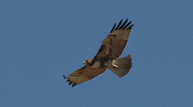
Bay Trail Bike Birding
After reading The Thing With Feathers and then Feathers: The Evolution of a Natural Miracle, I started being more interested in birds. Then I bought a Sibley Guide, and it got a little more serious. I’ve always enjoyed the Bay Trail, on several occasions riding SF to Berkeley or the reverse. This weekend I rode from…
-
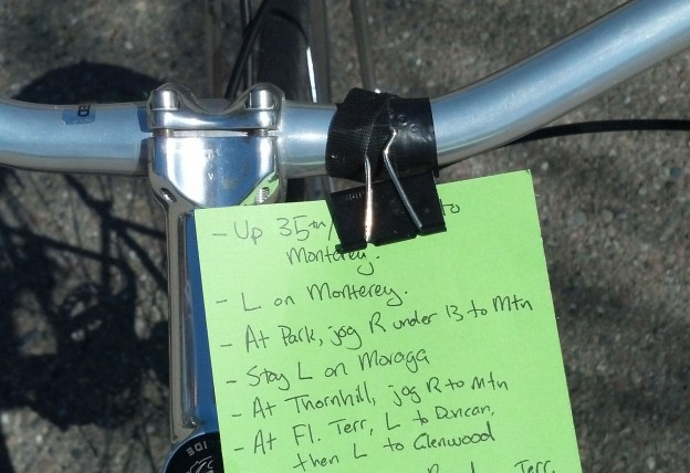
Bicycle Cue Sheet Holder
I’ve moved to Oakland from Berkeley, and so biking to things goes over longer distances and often I find that I need to bring a cue sheet. That meant I needed a way to hold a cue sheet. I already have a section of my handlebar taped over with electrical tape where I attach my…
-
Bike Camping: SF to Point Reyes Sky Camp
Last weekend I was the event host for a trip from San Francisco to Point Reyes with the NorCal Bicycle Touring and Camping Meetup. We ended up getting six people together for the trip, all from San Francisco and Berkeley, except one coming in from Sacramento. I had picked up a camping permit for Sky…
You must be logged in to post a comment.