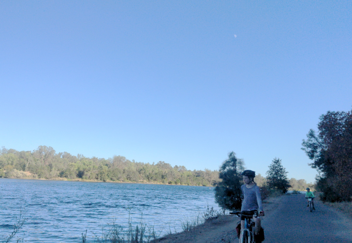
Introduction. This week, I was on a sort of staycation where I live in Oakland, off of work but not traveling someplace. So I decided to knock off of my to-do list something I have wanted to do for a long time: taking the train from Oakland to Sacramento to ride on the American River Parkway all the way to the Beals Point Campground by Folsom Lake. I love bike touring, especially in France and Germany where you can get on a train, go someplace and bike for a long distance and camp. There’s so many places you can do that in the United States, and this particular setup of the Capitol Corridor with the American River Parkway is as far as I know one of the few places you can do something like that in California.
I went with my two children who are 8 and 10. They have both done one bike tour in Germany, but the maximum day there was 33km (21 miles). And also, one of the children got sick and could not complete that tour. So it was with a little bit of trepidation that I brought both kids on this trip. I gave them the option whether they wanted to go or not, and they both chose to. We did a shakedown ride several days before from the north side of Oyster Point Regional Shoreline (by the shooting range) to the Union Landing Shopping Center (Krispy Kreme and In N’ Out), which was 55km (34 miles). That seemed about as far as either kid would be able to go, but it also seemed likely to be much harder than the American River Parkway because it’s largely on gravel and we had strong headwinds in the afternoon.
This post is partly narrative – about what we specifically did — but I’m mostly writing it from a functional perspective: the things I would have wanted to know ahead of time. I had trepidation going in about making sure everything went well with the train and where we were going to eat and where we were going to sleep, and if we would have enough water in order to stay cool. As just one parent with two younger kids, the margin for error is smaller than if you’re just adult(s) doing this by yourself (although my wife was on call to drive out and pick us up if things went awry, so I did have that has a fallback; she broke her toe recently and had to sit this one out). So maybe I’m partly writing this for myself (if I ever do this ride again), but also for anyone else who was thinking about maybe doing this ride, but might have been intimidated by the logistics or knowing what to expect.
I. Train
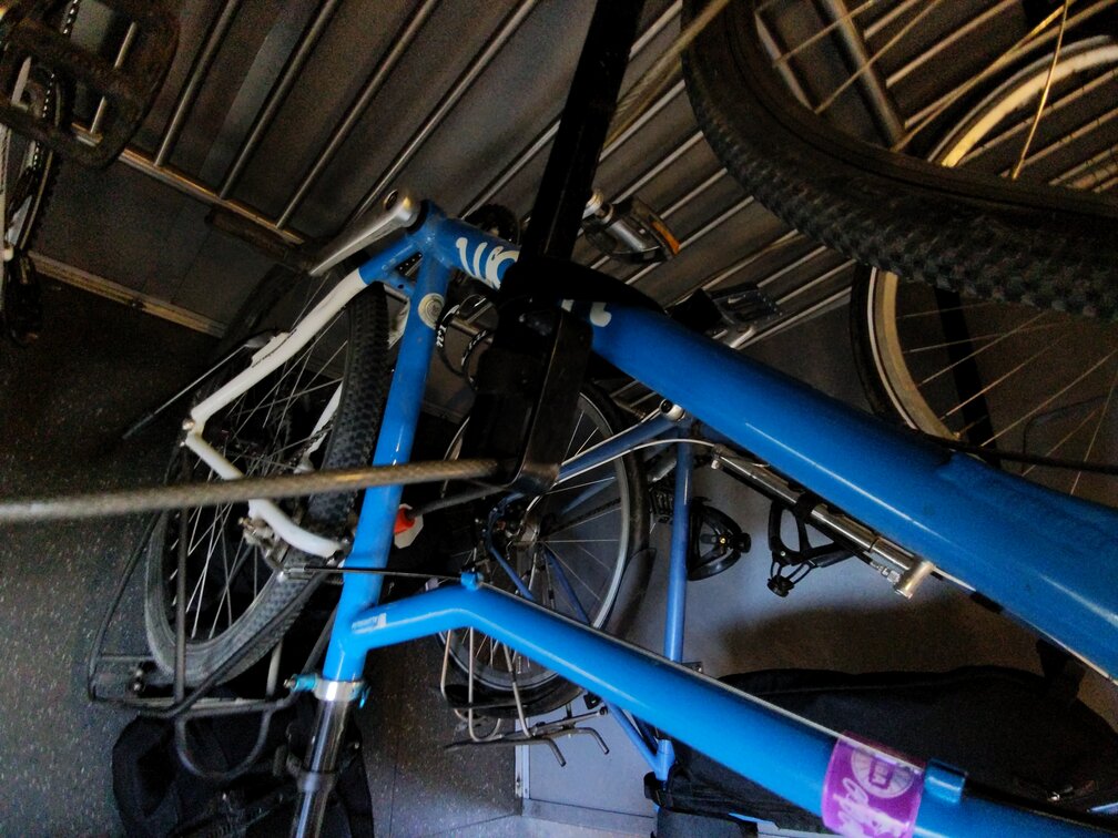
Test Ride. I had maybe taken a bicycle on Capitol Corridor once before, but if I had it had been at least a decade. So one day I did a test ride, biking down to Jack London Square and to ride to Emeryville on the train and then getting off and riding on my bike home. This was very helpful in order to be able to see what the layout is, what the cars look like, and so that I was not putting bikes onto the rack for the very first time when I had two children with me. I learned that there is hardly anyone going east on a weekday at 9 a.m. or 10 a.m., at least in July. There are both several bicycle cars with three bike racks, and also one car with dozens, at least on these midday trains. Because there was hardly anyone on it and we would only be three people, I knew that I could take any of those three-rack cars and I should be fine because they would probably all be empty. And in fact, both going and coming we just used a car that had three racks, it was easy to find ones that were empty. I used a single U-lock and a four-foot Kryptoflex to lock all three bikes.
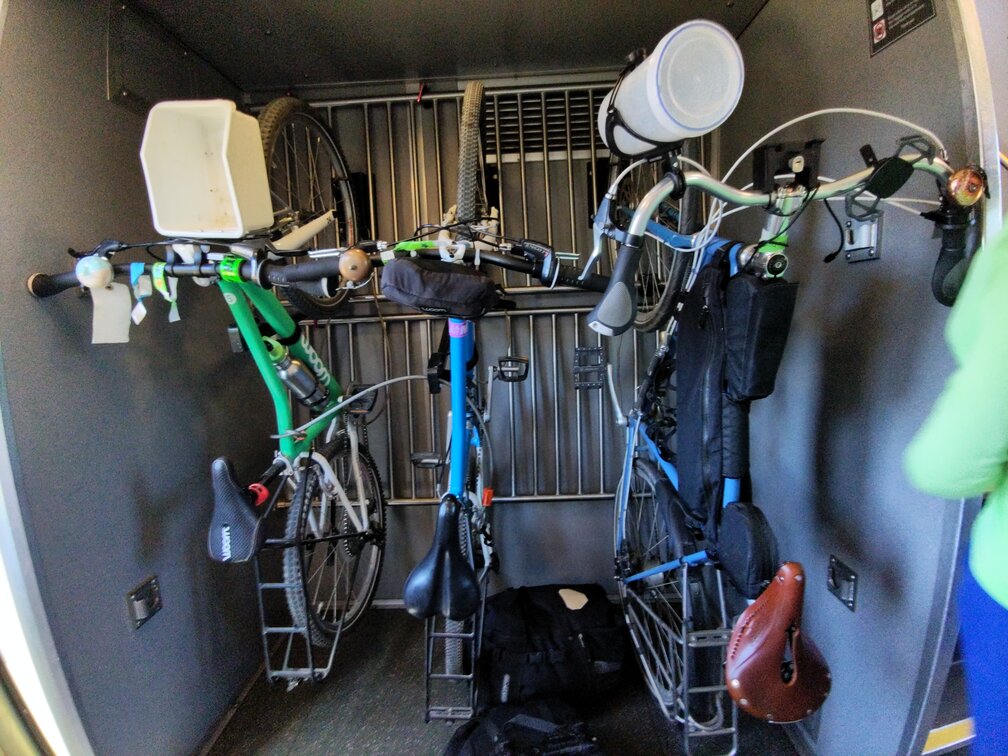
Boarding and De-Training. One of the most stressful things for me about bikes and trains is if you have a very short boarding window, then there’s a lot of stress to make sure that you can get all of your things onto the right car during the short boarding window. I have lots of memories of my wife and I flinging our bags on and trying to get our bikes onto a car and then trying to get it onto a rack on a SNCF or Deutsche Bahn train in Europe in a one-minute loading window at minor stations, and then trying to get everything secured while the train is rolling.
One can avoid all of that by loading on a train that originates at Jack London Square. Many of the Capitol Corridor trains originate or terminate at Jack London; but not all of them because some go to San Jose. If you can board on a train that originates at Jack London Square, then you have 10 or 15 minutes from when doors open until the train departs, which was very nice. So even if you had more than three people and had to find the dedicated bike car, you would have the time to do it without stress. It seems like it would still be very doable to load kids and bikes in the two minute window of the normal stop for trains coming through. We also had the similar long loading window on the way back because our train originated in Sacramento.
Getting to the station. Our kids are too young to bike on Oakland City streets to Jack London Square from where we live. So my wife drove us in a car and dropped us off. We found that Madison Street where it dead ends below 2nd was a good spot with not much happening where you can unload bikes from a car. I thought about parking overnight at Jack London Square, but all of the reviews at all the parking garages were terrifying with lots of reports of gas tanks being drilled and drained. It also added another layer of complexity because I have roof bike racks and I’d have to unload the bike before entering the garage and lock it and then drive in and find it again. So we decided not to do that option.
When to unload bags. One thing I learned (probably re-learned, likely this has happened to me before) on the way back it is best to keep your panniers on your bike until you’re in front of the car you know you want to load onto. Loading at Sacramento, I was in front of a car with a bike logo on it, and so I just unloaded all of the bags so that we were ready to get on. Then doors opened and the conductor told me that he thought I should go to the dedicated cargo bike car, and it was a stressful moment to figure out how to move the bikes with the bags already unloaded (do I re-attach the panniers? Have the kids carry them and try to walk the bikes?). Then I decided to clarify the instruction because there was no good reason for it and loaded onto the car that just had three bike racks, and the conductor said that was fine. I guess he somehow thought he was trying to be helpful by telling us to go to a car that would have more space for bikes? Anyway, just a reminder, bags should stay on and then just yank them off when you’re about to load the bike.
Coordinating with kids. My kids are still too young to be able to push their bike up onto a vertical hook rack like the ones on Capitol Corridor. And even if they could, the Capitol Corridor ones are particularly tricky when unloading because they have an extra hook that tends to get stuck on a spoke; in a couple of cases I had to hold the bike with one hand and rotate the front wheel with the other to get it unhooked. So in all cases loading and unloading, I put the kids in charge of bags, which they were to get up to a table up top when we were loading. And when we were unloading, they had to take the bags to 10 or 15 feet away from the car, out of everybody’s way, and then come back to the door and take the bikes from me as I unloaded them. That worked very well for teamwork loading and unloading.
II. Route
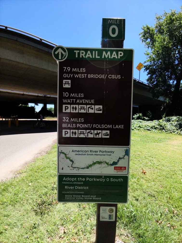
One of the great things about this route is that almost the entire way is a single signposted route, the Jedediah Smith Memorial Trail that runs within the American River Parkway. Beals Point is the terminus of the trail. So the only real navigation problem you have is to get from the Amtrak station to the Jedediah Smith Trailhead, which is in Discovery Park and then choosing where to cross the river.
Two things about the start:
Go Through the Amtrak Parking Lot. I could not figure out before arriving how one got underneath Highway 5 between the Amtrak station and The Old Sacramento Waterfront. There is a seemingly impenetrable snarl of freeway overpasses and on and off ramps, and the beginning of the I Street Bridge that makes the map almost unreadable as to understanding how a bicycle could get from the train station to the old Sacramento waterfront, even though it’s only maybe one thousand feet as the crow flies. I just figured we would go slow and figure it out, and we did. The answer is that you are going through the Amtrak parking lot, so if you exited the station and turned right, then there’s a long parking lot that continues as a sort of underpass underneath Highway 5, as you can see at this particular Google Maps Street View point. That gets you to the origin point of Second Street. And then you can basically immediately turn right on I Street, which takes you to the Old Sac Historic Park. Go straight until you reach the water and then there’s the bike path and you’re turning right onto it.
Go Over the Jibboom Street Bridge. The beginning of the Jedediah Smith Trail is where Google Maps says there is the American River Parkway Trailhead. This is just over the Jibboom Street Bridge. Unhelpfully, Google Maps currently will not allow bike navigation over the Jibboom Street Bridge. It will take you on this long detour to another bridge. But ignore that, if you’re using Google Navigation or directions and just bike over the Jibboom Street Bridge. You will see a zero mile marker for the Jedediah Smith Trail. From there on out there’s basically nothing to do but follow the mile marker signs. Since I had children – and you could even do this if you didn’t have children, I counted the mile markers aloud as if I were The Count from Sesame Street.
Which Side Of The River? Especially near the end, it does seem like there was a bike path on both sides of the river. We stayed on the north shore until River Bend Park, where there is a short bridge over to the south side – this seems like the only option at that point. But then at the Hazel Street Bridge there does become a bike path on either side of the river. We did cross to the north/west side of the river, which was fine.
III. Food / Water.
We mostly did this as a credit card tour, buying food along the way rather than packing it. We brought snacks, but – other than medium-boiled eggs for breakfast – no meals. It also makes for fun and interesting stops at different restaurants. I did not fully account for how difficult it would be to go out of the way to go to more interesting restaurants. Like, we biked to Bad Bakers, which is a really good donut shop, but it took us a good 40 minutes maybe to get there and back to the trail, partly because we have to do so many pedestrian crossings. With an eight year old and a ten year old, I’m not gonna bike on a four lane boulevard even if it has a bike lane. And like when we got to the intersection for Bad Bakers, it was across the street from us, but there’s only pedestrian crossings on three of the ways across the big boulevards, and so we’d have to do three pedestrian crossings to get there, and three pedestrian crossings to get back.
After that experience, we decided to mostly just go to restaurants that were closer to the trail. Panera Bread, although just mediocre strip-mall food, was right off of the bike trail, so we ate there for lunch. Near the campground, we used a shopping mall on Folsom Boulevard that has Folsom Kebab and Mario’s Early Toast in it for dinner and breakfast, respectively. That’s just a short climb on bike paths out of the river valley. And then you have to bike along the sidewalk next to Folsom Boulevard for half a mile, but it seemed worth it to us. I made a Google Maps List of stops – restaurants that were close to the trail, and parks – which is here.
The weather prediction for the two days that we rode this was for a high of 88 on the first day and a high of 96 on the second day. And it does seem basically like 90 degrees is about the maximum of when a person can reasonably bike. Once you get above about 85, we needed to start soaking ourselves at every available opportunity, keeping our shirts constantly wet to stay cool (the kids started calling the drinking fountains “soaking stations”.
We brought about four liters of water carrying capacity, which seemed about right for hot weather. Kids each had a 20oz bottle and I carried 40 oz x 2 plus a 20 oz. Sometimes it seemed like it was excessive and I didn’t need to have the extra forty, but there is a fairly long stretch near the Sacramento side where there aren’t water fountains, so at least once we were glad to have all of the water that we had. On the way out we just went very slowly and finished a lot of the biking in the evening, arriving at the campsite at 8pm just before sunset. The next morning we were very motivated to bike when it was cool and so we actually knocked out the whole thing by 1pm taking much shorter breaks in order to make sure that we covered as much ground as we could before it got too hot to ride. Long sleeved synthetic shirts were best for sun protection, but also wet sleeves are cooler than no sleeves. I also was very happy to have brought a cup as a tool to fill the bottles, as most of the drinking fountains had no bottle-filler spigot.
IV. Sleeping
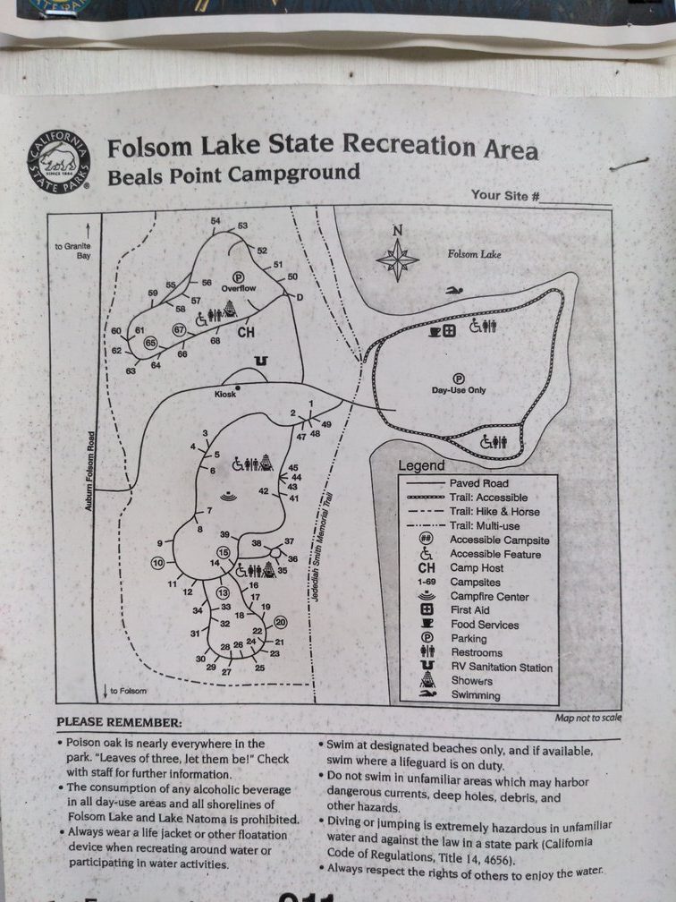
The only real option here for camping is Beals Point Campground. It’s a campground. Not the worst, not the best. One annoying thing about it with respect to the bike trail is that although the bike path goes directly past the campground, the only official way in involves going past the campground and then in. However, at site 36, 38°43’05.2″N 121°10’19.8″W, there is a cutoff trail between the trail and the campground — lot of poison oak on one side, but nevertheless, an option to reserve site 36 and skip the bike-around.
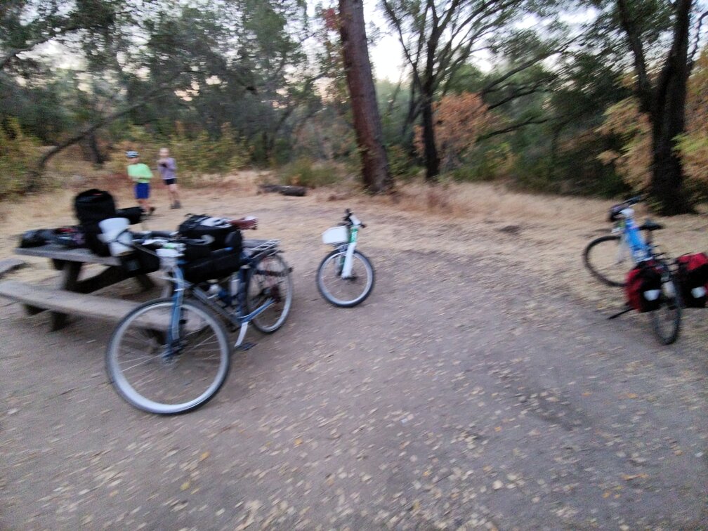
The two times we’ve been there it has had oddly large things happening. The first time there was an ultra-marathon happening (100 miles I think), and they had a huge finish line set up half a mile from the campground. They’d announce finishing runners like every 30 or 40 minutes throughout the night at full volume, same as if it were daytime. I’m still surprised that California State Parks would have permitted fully amplified announcing throughout the night next to a campground – filed a complaint, never heard back. Then this time when we went, there was a giant family reunion of like must have been 50+ people with two large wedding-style tents with klieg lights. On a Wednesday. All things considered, they were pretty respectful. There was chattering throughout the night, but nothing we couldn’t sleep through. Because I was carrying all of the gear for the three of us, we chose to not bring a tent because it’s California and it doesn’t rain in July. That turned out to be a perfectly fine decision. There were no mosquitoes and no critters or anything that bothered us in the night. Breakfast in the morning was just the hard boiled eggs that we had brought and the Panera baguette that we had brought along and that was actually surprisingly good enough to get us to Mario’s Early Toast for a waffle and pancake breakfast which fueled us all the way through the way back.
Leave a Reply