Update May 2018: The OSMAnd application accomplishes this task better than Overpass Turbo; see this post for more info.
*******
Campgrounds make for a quick cheap place for a bicycle tourist (or other tourist) to stop for the night, pitch a tent, and get a warm shower. Sometimes, though, it can be hard to tell where all of them are.
For any given region, there are usually some campground associations or governments that list a certain sets of campsites. However, in planning an upcoming bike tour around Normandy, I wanted to have a single map of campsites that cast a wide net. In Europe, the open-source mapping service OpenStreetMap is quite popular and often is the best source of data for geographical features. It’s not perfect. It is sort of like the Wikipedia of cartography: inclusive, but also prone to the occasional error or out-of-date information. Still, it’s exhaustiveness can be helpful for planning: it will tell you all the places there might be a campground.
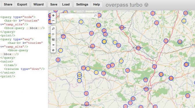
To get one particular type of map feature out of OpenStreetMap, the best tool is a service called “Overpass Turbo“. It allows you to make a request for one type of feature, and then shows all of them that appear on the current map. Making requests looks a little bit like computer code, but even folks who are not computer nerds can make simple ones. Like for campsites.
Here are the steps:
- Go to https://overpass-turbo.eu/.
- Find the geographic region that you want to search in. You can either do that by dragging the map, or typing in the name of a geographical location (state, region, etc.) into the search box on the map.
- Replace the entire query box with this (borrowed from this example for parking lots):
<query type="node">
 <has-kv k="tourism" v="camp_site"/>
 <bbox-query {{bbox}}/>
</query>
<print/>
<query type="way">
 <has-kv k="tourism" v="camp_site"/>
 <bbox-query {{bbox}}/>
</query>
<union>
 <item/>
 <recurse type="down"/>
</union>
<print/>
Then click “run”.
The search may take a while. The more territory you had displayed on the map, the slower it goes. A search for all the campgrounds in a city will take a few seconds; a search for all the campgrounds in a region or state will take a couple of minutes or may not complete at all. You may need to reduce the size of the map that is displayed, to make the request in smaller chunks.
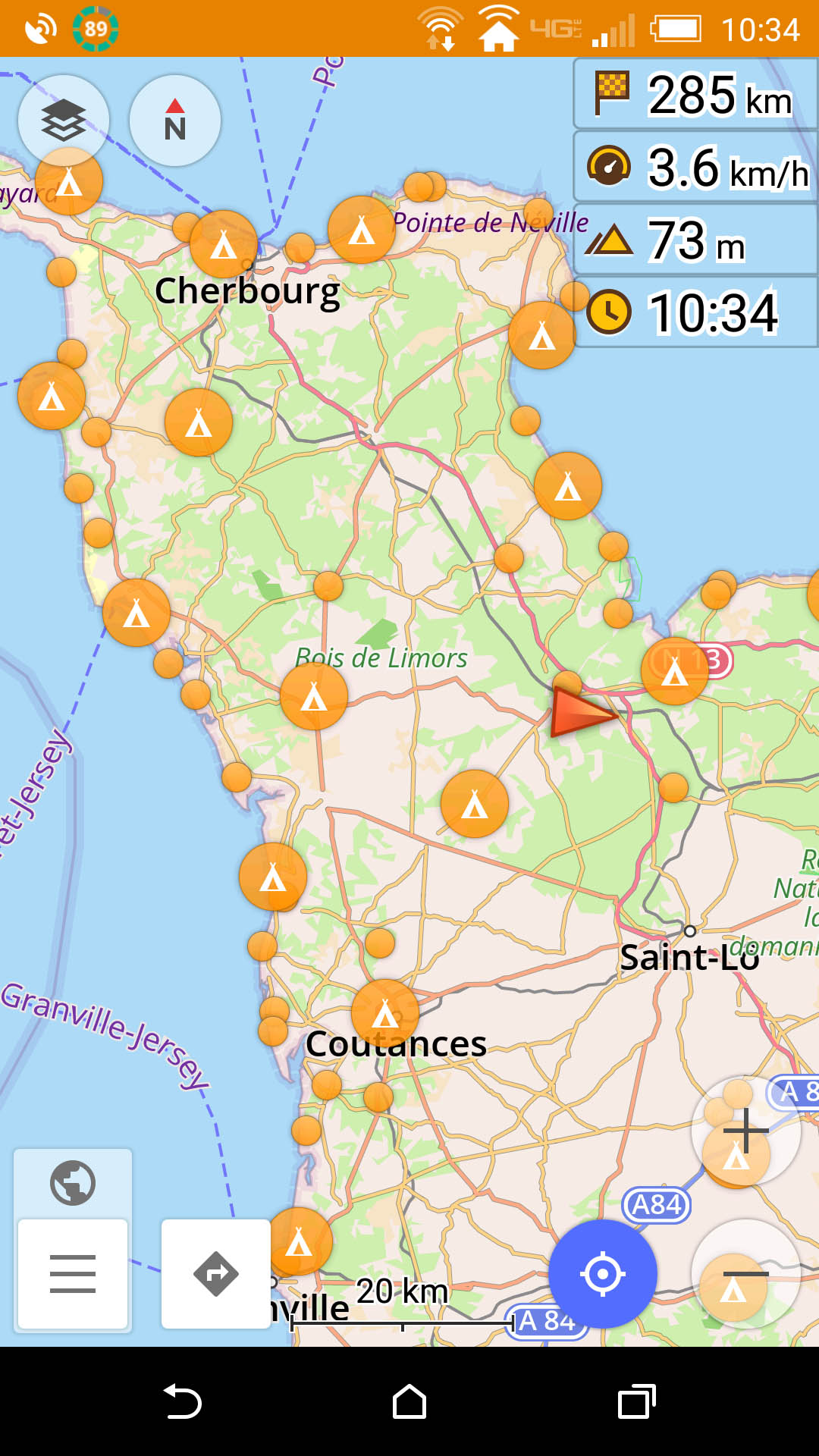
You can get a shareable link for the map you’ve created, but it will have to re-run the query when someone else clicks on it. I found it most useful to use the export button to export my data as a GPX or KML file, and then importing it into a Google “My Map“. I then changed the style (click “uniform style”, “All items”, then the little paint bucket) so that the campsites show up as green tents. You can see that map here. Either on Overpass Turbo or in the Google Map, where there is additional information about a campsite, like its name or website, that information will appear when you click on the icon. That can help in evaluating whether the information is current and other information about it. Now as I am planning my route, I can take into account where the campsites (probably) are.
You can also get this information through OSMAnd, which (I’m updating this post after the tour) is what I actually ended up doing most of the time in Normandy. Tap the “layers” icon in the top left, tap “POI…”, tap “Search”, type “camp” and choose “Camp site” (make sure you do not tap “former prison camp” which also shows up and which would be a very different experience). It will initially give you a list of the closest campsites; click on the map-with-pin icon in the bottom right.
Leave a Reply